GIS analyst · Geospatial engineer · Turin

M. Daud
Tasleem

I build WebGIS tools, spatial data pipelines and GeoAI models for infrastructure and natural-hazard work, from the raw data to the map someone has to make a decision with.

  • 7 peer-reviewed papers
  • 180+ citations
  • 550+ freelance GIS projects

01 Selected work

Research that shipped, and tools clients use.

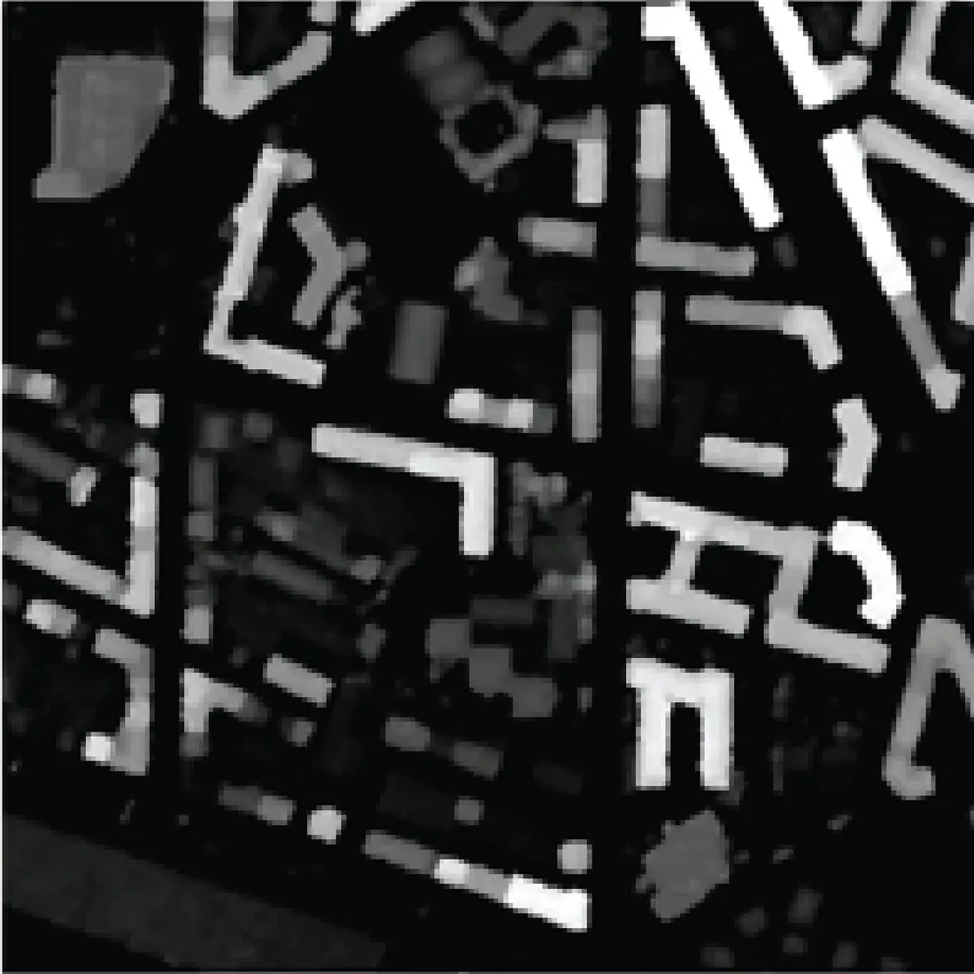
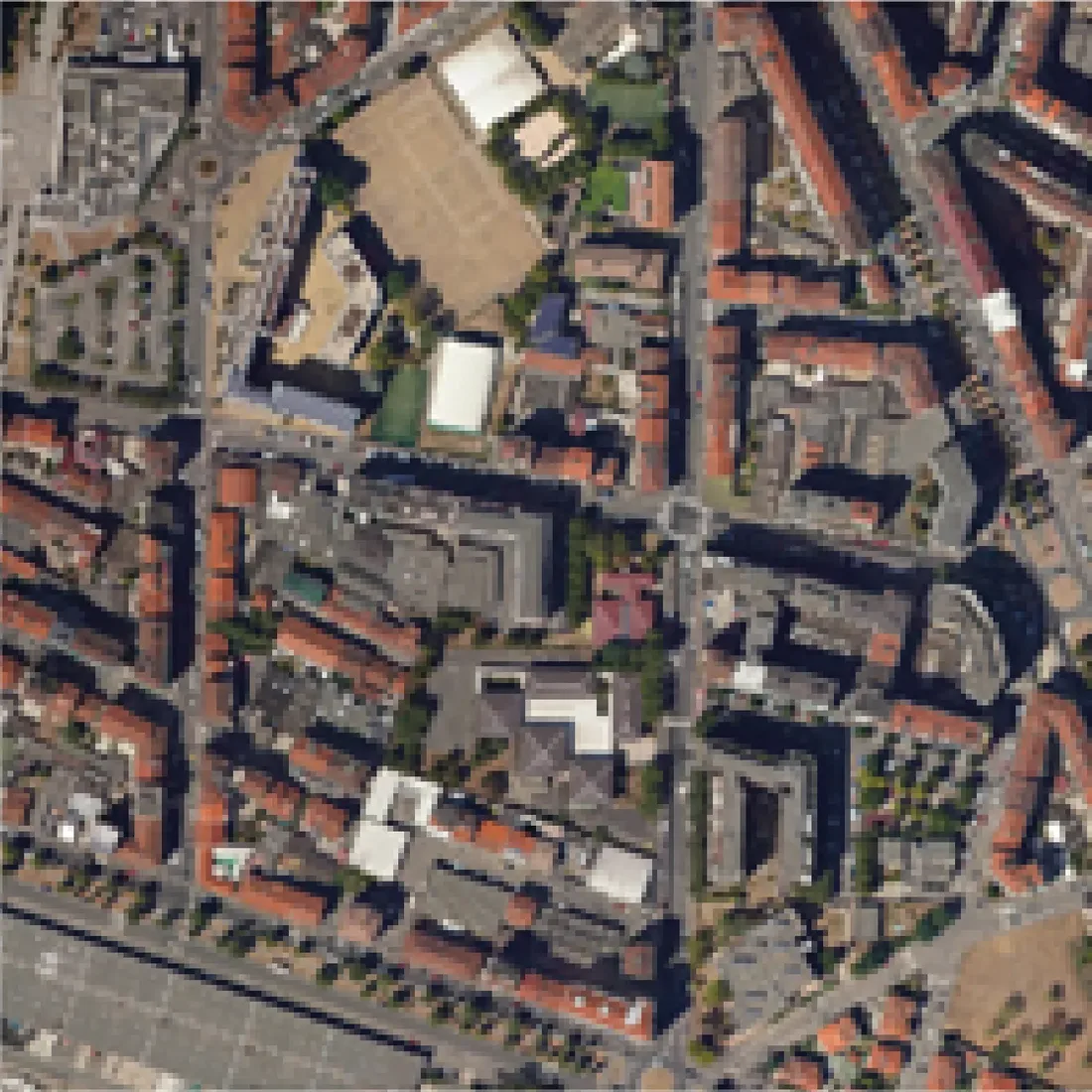
Very-high-resolution ortho image of a dense urban block in Turin. Input ortho Under the lens: height (DSM)

GeoAI · Scientific Reports (Nature) · 2024

Building footprints from ortho imagery

DeepLabv3 and U-Net segmentation with RGB and height (DSM) fusion, benchmarked across five architectures on very-high-resolution imagery. Move over the image: the lens shows the height layer the fused models also read.

Architectures
5
Input
RGB + Z
Citations
35
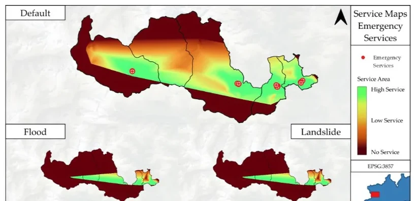
Service-area maps for emergency facilities in the Orco Valley under default, flood and landslide scenarios.

Natural hazards · Sustainability (MDPI) · 2023

Which roads fail first when the valley floods?

A multi-hazard road network analysis for the Orco Valley: flood and landslide scenarios, service areas for hospitals and public facilities, and origin-destination travel times, on a PostGIS database built from open 2D and 3D data. The terrain at the top of this page is the same valley.

Scenarios
Flood · Landslide
Method
O-D · Service areas
Citations
27
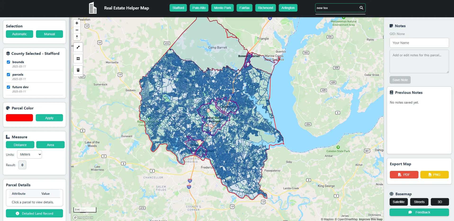
Mapbox parcel review map with a county-wide parcel selection, side panels and export controls.

WebGIS · Mapbox GL JS · Client work

Parcel review WebGIS for a real-estate client

A browser map for reviewing parcels without leaving the map: custom basemap, polygon-draw selection, attribute filters, notes and CSV/KML export, built directly on Mapbox GL JS.

Selection
Polygon draw
Export
CSV · KML
Stack
Mapbox GL
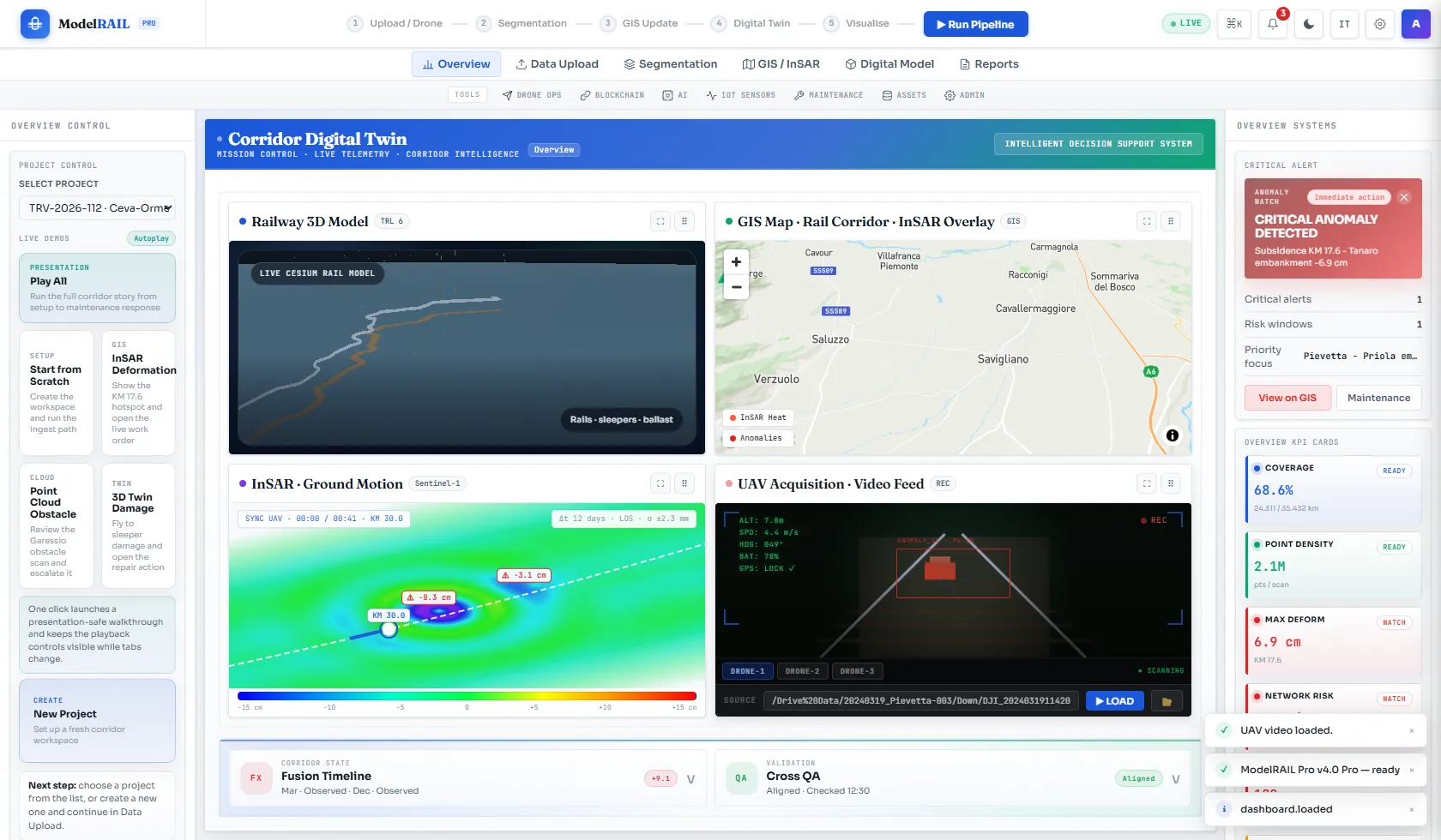
ModelRAIL corridor digital twin dashboard with 3D model, rail map, InSAR ground motion and video panels.

Rail infrastructure · Flagship prototype

ModelRAIL

Rail monitoring that puts GIS layers, InSAR deformation, UAV inspection and point-cloud review in one decision surface, with audit logging and report export.

Data
InSAR · UAV
Views
Map · 3D
Stack
Cesium · Node.js

More projects

02 Research

Funded work on hazards, resilience and the meaning of spatial data.

180+citations
7publications
3h-index
Google Scholar ↗ ResearchGate ↗

Citations from ResearchGate, September 2026. h-index from Google Scholar.

Papers

  1. Sustainability · 2024 · 45 citations Comprehensive Analysis of the Use of Web-GIS for Natural Hazard Management: A Systematic Review Tasleem M. D., Ugliotti F. M., Osello A.
  2. Scientific Reports · 2024 · 35 citations Revolutionizing Urban Mapping: Deep Learning and Data Fusion Strategies for Accurate Building Footprint Segmentation Dabove P., Tasleem M. D., Olivotto L.
  3. Sustainability · 2023 · 27 citations Enhancing Risk Analysis toward a Landscape Digital Twin Framework: A Multi-Hazard Approach in the Context of a Socio-Economic Perspective Ugliotti F. M., Osello A., Tasleem M. D., Yilmaz O. O.
  4. Smart Cities · 2025 Spatial Insights for Building Resilience: The Territorial Risk Management & Analysis Across Scale Framework Ugliotti F. M., Tasleem M. D., Iacono E.
  5. Sustainability · 2026 Rethinking Education on Critical Infrastructure Resilience and Risk Management Ugliotti F. M., Zucco M., Tasleem M. D.
  6. geodaysIT, Bari · 2023 · Talk The Use of Open-Source Machine Learning Techniques for Urban Features Extraction Tasleem M. D.
  7. Politecnico di Torino · 2023 · MSc thesis Corridor Mapping Processing Using the Machine Learning Approach Tasleem M. D.

Funded projects

  • 2023 – now GIS-BIM web platform for natural-hazard decision support MANAGE 5.0 · Politecnico di Torino
  • 2023 Urban heat vulnerability index from thermal survey data ESA InCubed · DigiSky
  • 2023 Multi-hazard road network analysis, Orco Valley NODES (PNRR) · Politecnico di Torino
  • 2022 – 23 Airport corridor mapping with machine learning, 91% F1 Sponsored MSc thesis · DigiSky, Politecnico di Torino
  • 2022 QGIS plugin for semi-automatic flat-roof extraction, 92% accuracy Internship · DigiSky

The semantic layer

Describing what spatial datasets mean, encoding it as metadata, and turning plain-language questions into spatial operations a system can run and defend.

  • GeoBrief live Infers semantic metadata from a dataset and checks whether a question can be answered from its fields.
  • typed-workflow-layer A typed layer that maps a geo-analytical question to a checkable spatial workflow.
  • geo-annotation-kit Semantic annotation of attributes with inter-annotator agreement.
  • geoqa-study-harness User-study harness for geo question answering, with comparable exports.
  • natech-guidance-qa Retrieval-grounded QA over the JRC Natech guidance, with measured retrieval quality.

03 Open-source tools

Small GIS utilities that fix one problem properly.

netsimplify

Simplifies infrastructure line networks while pinning shared vertices, so junctions never disconnect.

line-noder

Finds every line-line intersection and builds a planar edge-node graph. STRtree backend, 2.5× faster on large networks.

topo-coverage-simplify

Simplifies polygon coverages arc by arc so neighbours stay identical. No gaps, no slivers.

cog-focal

Tile-streamed slope, aspect, hillshade and focal stats on Cloud-Optimized GeoTIFFs, with no seams at tile edges.

restoration-zonal-diff

Monte Carlo zonal difference of ecosystem-service value between land-cover scenarios, with credible intervals.

laz-tile-index

Portable JSON sidecar indexes for LAS/LAZ point clouds, with a browser preview of bbox queries.

All repositories on GitHub ↗
Portrait of M. Daud Tasleem.

04 About

From civil engineering to GIS.

I studied civil engineering at NUST in Pakistan and did my MSc in infrastructure engineering at Politecnico di Torino, where my thesis used machine learning for corridor mapping.

Since then I have worked on hazard and resilience research with Politecnico di Torino and DigiSky, alongside freelance GIS work. On Upwork I was Top Rated for three years, with more than 550 projects for clients that include the WHO and oil and gas operators in the US and Canada.

I'm most useful where analysis meets software: a PostGIS schema, a QGIS plugin, a segmentation model or a WebGIS front end, built so someone else can check and re-run it.

Education

  • MSc Civil Engineering (Infrastructure)Politecnico di Torino · 2020 – 2023 · 103/110
  • BE Civil EngineeringNUST, Military College of Engineering · 2016 – 2020

Worked with

World Health Organization · Politecnico di Torino (DIATI) · DigiSky · ESA InCubed · NODES · MANAGE 5.0

Stack

WebGIS
Mapbox GL JS, Leaflet, ArcGIS JS, Cesium, GeoServer, OGC services
Analysis
Python, GeoPandas, Rasterio, GDAL, PostGIS, QGIS/PyQGIS, ArcGIS Pro, FME
GeoAI
PyTorch, TensorFlow, DeepLabv3, U-Net, SAM, SAR/optical fusion
Remote sensing
Sentinel-1/2, Landsat, PSI/SBAS InSAR, Google Earth Engine, SNAP
05 Contact

Have a spatial problem, or a role in mind?

Based in Turin (CET). Open to GIS roles, research positions and freelance projects, remote or on-site in the EU.

daudtasleem215@gmail.com